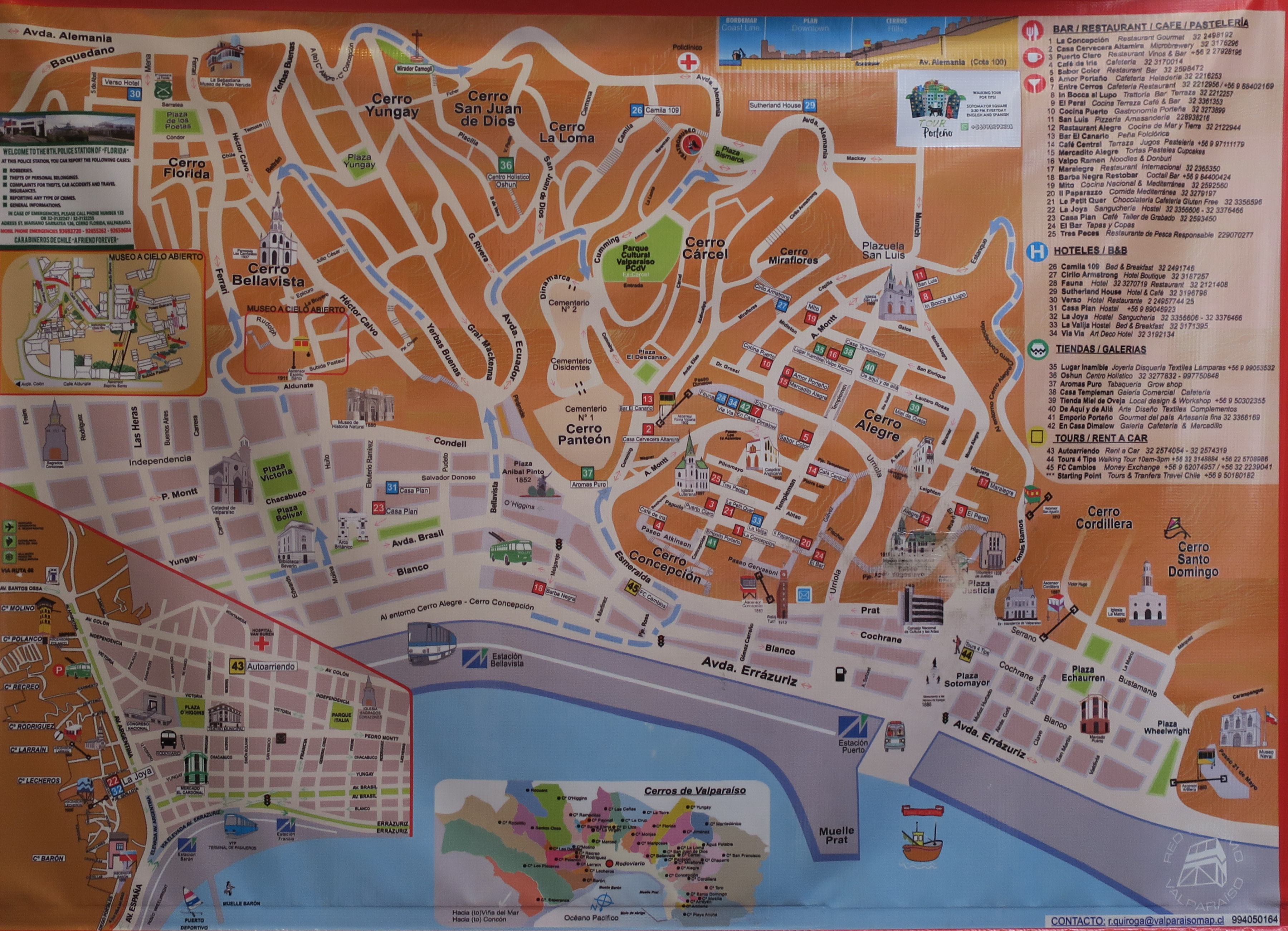
Valparaiso city center showing funiculars (acensores)
Torres del Paine national park map 1
Torres del Paine national park map 2
Torres del Paine national park map 3
Torres del Paine national park map 4
Torres del Paine national park map 5
Torres del Paine national park map from book
Puerto Natales area map 1
Extreme southern Patagonia
Punta Arenas/Puerto Natales/parks map showing our route
Puerto Natales street map
Milodon cave park map
Torres del Paine national park
Punta Arenas street map
Southern Patagonia including the Strait of Magellan
Chiloé Island -north end
Chiloé Island - extreme north end
Chiloé Island - complete island
Lake District - large scale, huge file to download
Lake District -large scale, smaller file (lower resolution)
Lake District - central area only
Puerto Varas downtown area
Santiago city map
Santiago - city center detail
Santiago - metro map
Lima, Peru historic city center - 1
Lima, Peru historic city center - 2
Lima Peru map of Miraflores and San Isidro districts
Lima, Peru city districts
Lima, Peru map of Miraflores district
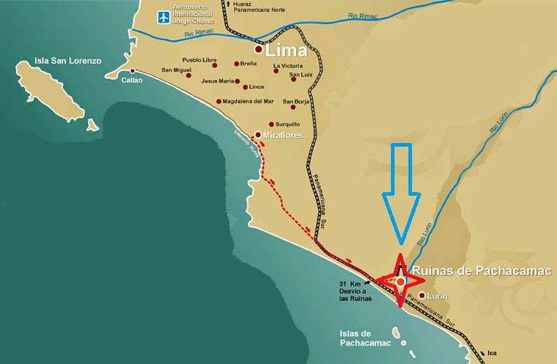
Lima, Peru area map including Pachacámac
Pachácamac ruins map
Pachacámac map 2
Pachacámac map 3